
Previous New Haven Residents by Era
Research into previous residents needs an era map before it needs a name. The source table below shows which record can bridge a date and what kind of relationship it supports. New Haven land records begin around 1951 or 1952 in the SearchIQS material, while maps go back to 1835. Directory collections reach the nineteenth century, census records reach 1950, and archival court or probate material has collection-specific limits.
| Source | Years It Covers | Where Held | What It Shows |
|---|---|---|---|
| New Haven land records | About 1951 or 1952 to present | City Clerk and SearchIQS | Grantor, grantee, instrument, legal description, image |
| New Haven maps | 1835 to present in SearchIQS | City Clerk, Yale, LOC | Street, lot, map reference, physical continuity |
| New Haven directories | 1840 to about 1990 | NHFPL and Whitney Library | Names, spouses, occupations, reverse address entries |
| Federal census | 1790 to 1950 released | National Archives and library access | Household, age, relationship, occupation, enumeration address |
| Sanborn and historical maps | 1886, 1901, 1923-24, 1923-1951, 1973; Yale 1824-1995 | Yale, LOC, libraries | Footprints, lots, uses, street changes |
| Probate and obituary endpoints | Probate key data from 2011; other dates vary | Probate District, NHFPL, archives | Death, heirs, fiduciary or dated notice clues |
This is a backward trail, not one database. A gap between sources is useful information. Mark it as a missing volume, unavailable image, address change, protected record, or unverified identity.
Start With the New Haven Parcel Card
The current parcel card gives the house-history search its anchor. Record parcel ID, MBLU, current owner, situs, mailing address, assessment date, legal description, map reference, and last sale information. New Haven VGSI supports Address, Owner, Acct#, MBLU, PID, and All modes. The assessor card is reference data. It is not a deed and it does not list every person who used the building.
Keep three relationships separate: current assessor owner or mailing record, deed transfer parties, and historical occupants. A company, trust, nominee, or successor can appear in a deed. A person listed in a directory can be a household member without being the owner. A probate fiduciary can connect to an estate without showing a current address.
When the parcel is a condominium, right-of-way, mobile home, water area, or suppressed record, the OPM and COG parcel type matters. Geometry can remain visible while owner or mailing data is blank. Treat a blank field as a data or privacy boundary, not as proof that the property had no owner.
Read New Haven's Latest Instrument
Search the latest owner as a grantee in the municipal clerk's land-record index, using the approximate purchase date and any available instrument reference. Open the record when the image is available. Capture grantor, grantee, instrument type, execution and recording dates, book and page or instrument number, legal description, prior reference, return address, consideration or conveyance-tax field when shown, and page count.
New Haven's SearchIQS help describes land index and images from approximately July 26, 1951 to present. A vendor PDF gives August 18, 1952, so the practical boundary is 1951 or 1952 and should be confirmed with the clerk. SearchIQS maps begin in 1835. Direct search fields were not captured because the live route met an automated access gate; do not borrow field behavior from another town.
Use the municipal clerk for certification. A vendor index or scanned image is a lead or reproduction, while a certified copy is the clerk's official product. Other New Haven County towns use local vendors and different coverage. A North Branford RecordHub start date is a comparison example, not a New Haven rule.
Note: The legal description can stay useful when a street number changes, a lot splits, or a building disappears.
Follow a New Haven Deed Backward
The deed chain is a transfer trail. Start with the current grantee, read the grantor, follow the prior instrument reference, and repeat until the online boundary or a missing book requires an office or archive route. Never skip the legal description. It can identify a lot when the street number is not stable.
- Save the current parcel ID, MBLU, situs, mailing field, assessment date, and legal description.
- Find the latest deed or transfer record and record grantor, grantee, instrument type, date, and reference.
- Search the prior grantor as an earlier grantee and compare the legal description or map.
- Use a map sheet when the street, lot, subdivision, or building footprint changes.
- Stop at a coverage boundary and move to the clerk, library, State Library, or archive rather than inventing a link.
The chain identifies recorded parties, not every past household. That chain supports previous residents research, but it does not prove occupancy. Once the property trail is stable, use the directory reverse section to test who appeared at the address in the target years.
Use New Haven Street and Party Indexes
New Haven's land-record workflow can begin with an address, a street index, a grantor, a grantee, or an instrument reference. SearchIQS advertises a street-based index and map coverage, but the live deed form was not safely inspected. Preserve the method used, the exact name spelling, the date window, and the result reference. A grantor-grantee search and a street search may reveal different parts of the same transfer.
RecordHub serves selected county towns, while other town clerks maintain their own office or vendor routes. If the online index is unavailable, request a specific book/page, instrument, party, street, or legal description from the municipal clerk. For older records, ask the library or State Library about microfilm, maps, finding aids, and archival copies.
A fraud-alert signup can watch up to ten New Haven names or companies for a new land filing. The alert is only a notice. The recorded instrument remains the evidence, and a suspicious filing should go to the clerk and appropriate authorities.
Maps Test New Haven Address Continuity
Yale's New Haven historical map index spans 1824, 1830, 1852, 1863, 1877, 1880, 1888, 1890, 1893, 1896, 1905, 1910, 1915, 1923, 1928, 1931, 1941, 1955, and a 1995 aerial photograph. Sanborn sheets cover 1886, 1901, 1923-24, a 1923-1951 set, and 1973. These dates let a researcher place a directory entry near a physical map rather than assuming the current street number was always used.
The Yale New Haven historical map index is the source for the image below.
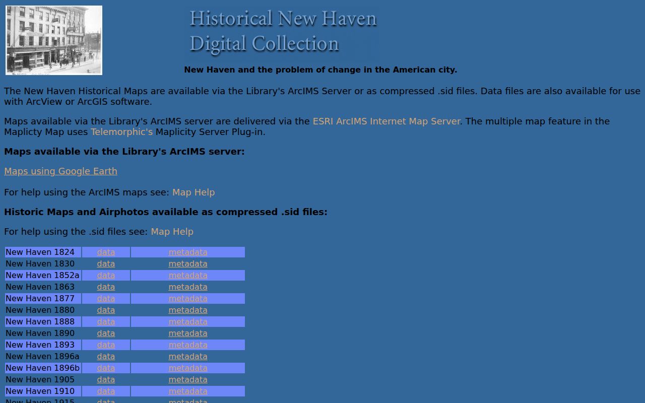
The map index gives a way to test a lot line, footprint, street alignment, or name change when a deed and directory seem to disagree.
The research did not verify a single countywide renumbering year. Preserve the old number, current number, cross streets, parcel, deed reference, and map evidence. If the building was divided, demolished, or annexed, say so only when the sources support it.
Reverse Directories for New Haven Households
NHFPL's directories run from 1840 to about 1990, with the reverse address section beginning around the 1920s. For previous residents, search the name section, record the address, then search the reverse section for the same number. Compare the closest annual volumes. The entry can show a head of household, spouse, occupation, workplace, or business. It may omit other people, use a different street spelling, or follow a publisher convention that changes over time.
Waterbury and Meriden collections provide county cross-checks. Bronson's Waterbury run covers 1868 to 1990, while the Meriden Room covers 1868 to 1992. The New Haven Museum Whitney Library has directory series, maps, newspapers, manuscripts, and the Arnold Dana Scrapbook for house-history leads. The directory collection itself is described on the New Haven city directory collections page, while the backward address workflow keeps the focus on one property moving through time.
Census Years Anchor Past New Haven Residents
The federal census supplies a different snapshot from a directory. Population censuses from 1790 through 1950 are public under the 72-year rule, with 1950 the newest released census in the inspected source. A census entry can show household, age, relationship, occupation, birthplace, and enumeration address. The enumeration district, ward, street label, and county boundary may not match the modern parcel.
The National Archives census research guide supplies the release boundary shown below.
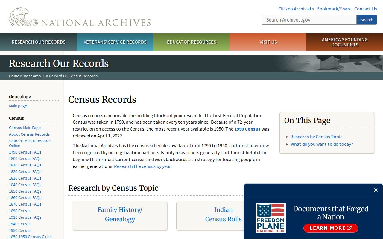
The census guide helps set a firm historical limit before a researcher treats a modern source as if it reached the same era.
Pair a directory year with the nearest census year, then use a newspaper, probate record, vital certificate, or map to test the name and address. A census household is not a complete occupancy list, and a directory line is not a census substitute.
Fill New Haven History Gaps
NHFPL offers a paid obituary lookup rather than a free, name-searchable county index. A request supplies the name, death date or window, residence town, requester contact and delivery details, payment, and any extra clue. The service searches five days after death, has a one-to-two-week target, and does not guarantee a result. Newspaper microfilm can extend the search, while probate can point to a fiduciary or heir.
The Whitney Library holds manuscripts, maps, photos, newspapers, scrapbooks, and local guides. The Connecticut State Library holds finding aids for New Haven County court material, probate, naturalization, jurors by town, licenses, guardians, military and pension records, and other historical categories. The municipal clerk remains the route for a certified modern deed.
For an address-specific request, name the street, estimated occupancy years, known owner, parcel or map reference, desired directory volume, and record format. A precise request helps a librarian or clerk locate the right box or shelf without turning a gap into a guess.
Past New Haven Households Need Caution
Previous residents should be reported with an era, source, and relationship label. Use “listed in the 1928 reverse section,” “grantor on the recorded deed,” “household member in the 1940 census,” or “named in a death notice.” Avoid converting a former address into a current whereabouts statement. A current owner, a recorded grantor, a historical directory resident, and a probate fiduciary are different roles.
- Grantor
- A party shown transferring an interest in a recorded instrument.
- Grantee
- A party shown receiving an interest in a recorded instrument.
- Chain of title
- A sequence of recorded transfers used to follow an interest in a parcel.
- Legal description
- The deed's description of land, which can be more stable than a street number.
Lawful house history. Use previous residents material for genealogy, preservation, local history, and estate research. Do not use a dated name or address to stalk, harass, intimidate, or harm anyone. Stop when a privacy or safety program protects a person.
The New Haven street directory supplies the current parcel and address chain when the historical trail needs a modern starting point. A source-dated gap is a valid result when the record is sealed, missing, outside coverage, or not safely available online.